Almost unexpectedly we seem to be so far south! The weather, though now fine, had recently been wet so we decided again to postpone the Yagur to Nahal Oren leg until April and to start where we left off last time, near Tishbi Winery. That is close to Ronnie and Carole’s home in Pardes Hana, and so we had the great pleasure staying there rather than at a hotel.
We met at the house for breakfast – courtesy of Carole (wonderful homemade granola) – and left a car at a shopping mall beside Hadera Station where we planned to end the day. Carole then dropped us at our starting point and we set off in sunny mild weather. Perfect.
 It was a beautiful easy hike uphill past a stranded Naval patrol boat through the southern part of Ramat Hanadiv, the beautiful location of the Memorial Gardens containing the tomb of Baron Edmond James de Rothschild. A strong Zionist, his large donations lent significant support to the movement during its early years, which helped lead to the establishment of the State of Israel.
Ramat Hanadiv was formerly the location of Umm el-‘Aleq, a small Arab village where in the 19th century a farmstead (Beit Khouri) was constructed by the Christian Arab family of el-Khouri from Haifa. French Baron Edmond James de Rothschild purchased the land from the el-Khouri family as part of his project to establish Zichron Yaakiv which he had previously funded in 1892. The Jews coming during the Third Aliyah in 1919 to Umm el-‘Aleq changed its name to “Ummlaleq” (“the miserable one”); their diaries recorded conflicts with the evicted Arabs, as well as malarial mosquitoes proving to be an impediment to settlement within the region.[1]

Baron Rothschild died in 1934 at Château Rothschild (Boulogne-Billancourt). His wife Adelaide died a year later on 29 December 1935. They were interred in the Père Lachaise Cemetery in Paris until April 1954 when their remains were transported to Israel aboard a naval frigate. At the port of Haifa, the ship was met with sirens and a 19-gun salute. A state funeral was held with former Prime Minister David Ben-Gurion giving the eulogy, following which Edmond de Rothschild and his wife were re-interred in a crypt in the Memorial Gardens of Ramat Hanadiv. For his Jewish philanthropy Baron Edmond became known as “Hanadiv HaYadu’a” (Hebrew for “The Known Benefactor” or “The Famous Benefactor”) and in his memory his son bequeathed the funds to construct the building for the Knesset.

The trail passed Ein Tzur and a number of ancient ruins including a Roman bathhouse before climbing climbed gently through lightly wooded rocky hillsides with a spectacular display of spring flowers that were to be a highlight throughout our three days on the trail.
From here we made our way down a rocky and at times steep descent to the coastal plain, clambering over the high speed railway track as the trail underpass was heavily flooded.
 We walked alongside Nahal Ha’Taninim (Crocodile River) where the heavy rains in recent weeks had turned areas of normally dry land into temporary swamps and lakes. It is probably rare to gain an insight into how the area must have looked at the time the Cabra swamp was infested by crocodiles – it was easy to imagine.
The High level aqueduct, constructed in the 1st century CE, started at the Shuni spring  located about 7 km north-east of the city and passes Beit Hananya and along the beach north Caesaria. Its head of water when reaching Caesarea was 8.5 m, with long sections supported by arcades. The average effective delivery of the High level aqueduct was 300 cubic metres (300,000 litres) per hour – enough for a city of 50,000 inhabitants. Indeed, its capacity of 145 liters per day per person is similar to the consumption in modern cities of developed countries.
 Ten inscriptions have been found attached to the High level aqueduct. Nine are in Latin and one is in Greek, the latter referring to repairs made by order of the Roman proconsul of Palestine in / after 385 CE. The nine Latin inscriptions mention three Roman legions active in repairing (not the actual construction) the High level aqueduct during Hadrian’s reign, about 130 CE: five inscriptions refer to Legio X Fretensis (of the sea strait), two to Legio VI Ferrata (ironclad), one to Legio II Traiana Fortis (valiant), and another one is uncertain. The prominent one attached to the aqueduct close to Beit Hananya comprises of legionary insignia of the Xth Roman legion and a tabula ansata (table with dovetail handles) with the text: IMP CAES / TRAIANVS / HADRIANVS / AVG FECIT / PER VEXILLATIONE / LEG X FRETE or:
Imperator Caesar Traianus Hadrianus Augustus [caesar Hadrian 117 – 138 CE] made [this] by means of a detachment of the legio X Fretensis.
We were so impressed walking beside the aquaduct west from Beit Hananya we went too far and had to double back to get back on to the Trail. We passed under Route 2 bent double (hard on Rafi given his height!) to Jisr al-Zarqa, a large costal arab town and stopped for lunch beside the small picturesque fishermen’s village nearby.
From now, heading South, we were going to spend a lot of time until we reached Tel Aviv walking along the sea shore. Fortunately the rain had left large areas of firm sand and the camber was slight, so it was easy walking and not too long until we reached Caesaria itself – entering through the Northern service entrance (and by-passing the pay booth… ) to stop for refreshments. Although this was not a time to go round the ruins, and we had all been there several times, it is a fascinating site well worth a half day visit.
The ancient city of Caesarea Maritima was built by Herod the Great about 25–13 BCE as a major port. It served as an administrative center of Judaea Province of the Roman Empire, and from 13 BCE as the capital of the Byzantine Palaestina Prima province. Herod built a palace here with a pool jutting out to the sea and it was the official residence of Roman procurators and governors, including Pontius Pilate. During the 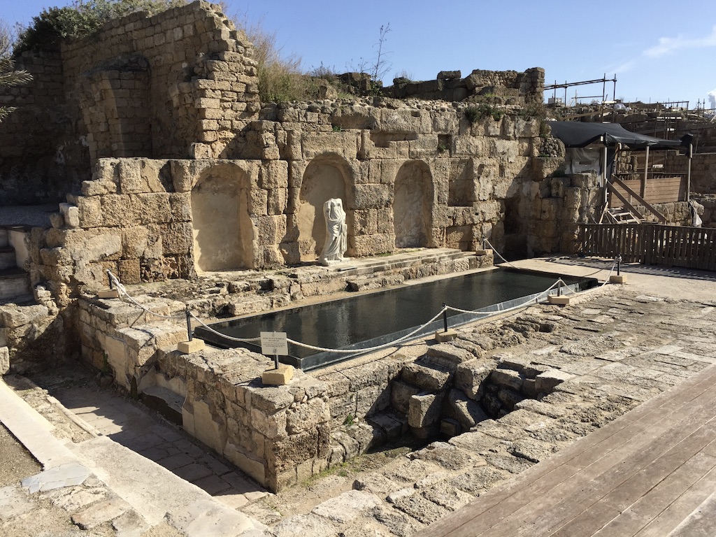 Muslim conquest in the 7th century, it was the last city of the Holy Land to fall to the Arabs. The city degraded to a small village after the provincial capital was moved from here to Ramleh and had an Arab majority until the Crusader conquest. Under the Crusaders it became once again a major port and a fortified city. It was diminished after the Mamluk conquest.[4] In 1884, Bosniak immigrants settled there establishing a small fishing village.[4] In 1940, kibbutz Sdot Yam was established next to the Bosniak village. In February 1948, the Bosniak village was conquered by a Palmach unit commanded by Yitzhak Rabin, its people already having fled following an earlier attack by the Lehi paramilitary group. In 1952, the modern Jewish town of Caesarea was established near the ruins of the old city, which in 2011 were incorporated into the newly-created Caesarea National Park.
Up until Caesaria it had been a magnificent few hours hiking across the southern tip of the Carmel mountain range, down to the coast, along the beach following the quaduct, in perfect walking weather with wonderful views and beautiful flowers.
From here on, I’m afraid, the day became more of a slog. We trail took us inland through sand dunes south of Caesaria (not easy hiking), and them along the side of Route 2 before walking the last stretch of the Hadera River beside the power station to the sea. After crossing a bridge over the River it was a long boring straight stretch to Givat Olga. There, the Trail has not been adapted to cope with extensive construction work, so it took a dash from across the turn off from Route 2 to make it to the shopping centre car park where we had left our car, arriving in time to drive the short distance back to Carole and Ronnie – in time for a whiskey in the garden at sunset before dinner…
